Transform your BioBase map into a polished, professional-grade map complete with custom legends and your logo—all for as little as $300!
Purchase GIS Services
GIS order form
GIS order form
Partner with our GIS team to turn raw sonar logs and legacy datasets into publication quality deliverables. We handle data cleaning, QA/QC, multi survey alignment, and custom spatial analyses — so you get accurate, decision ready maps and metrics.
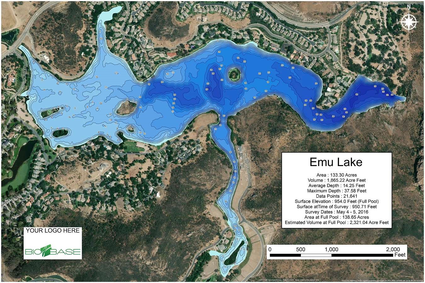
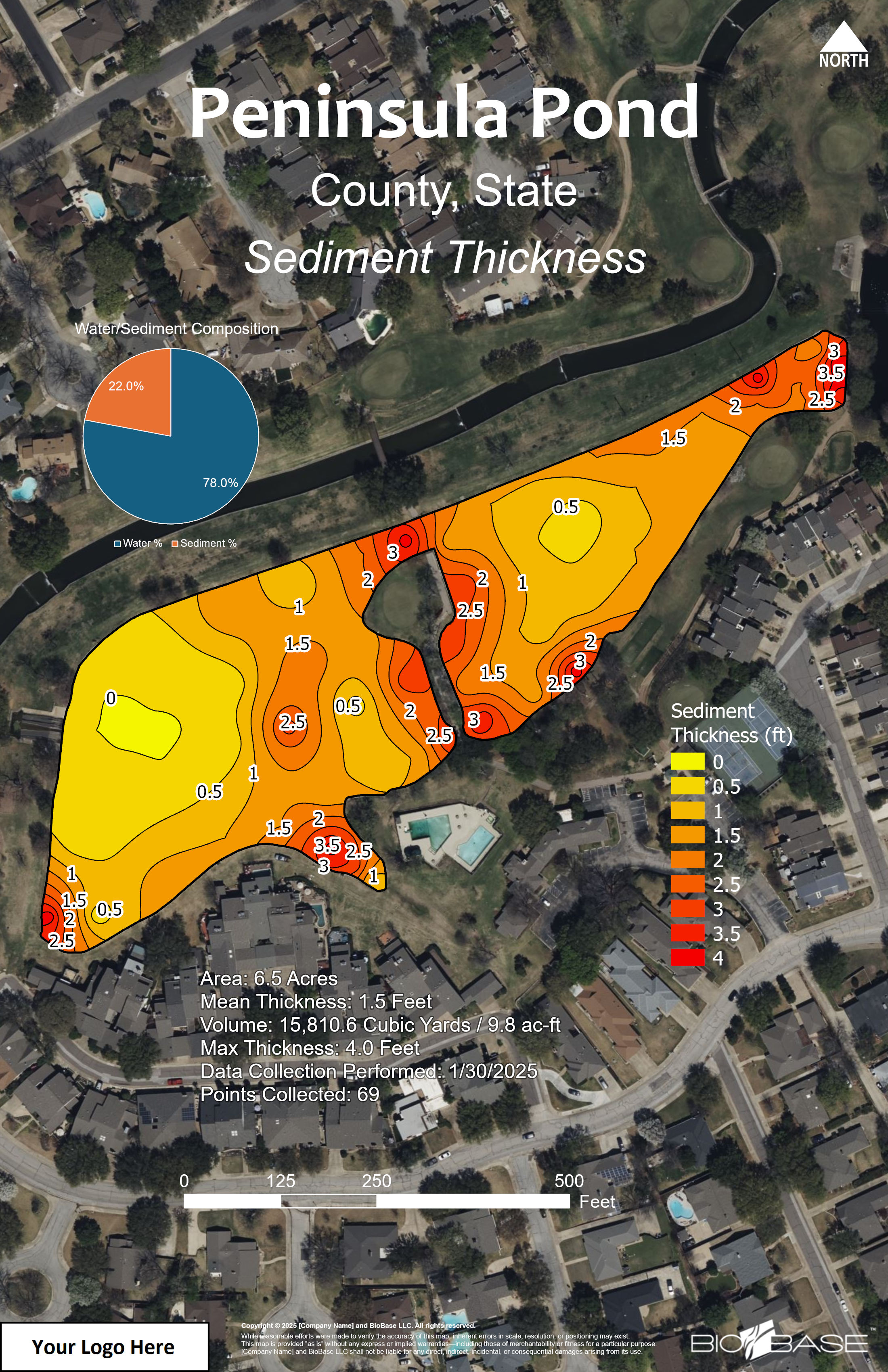
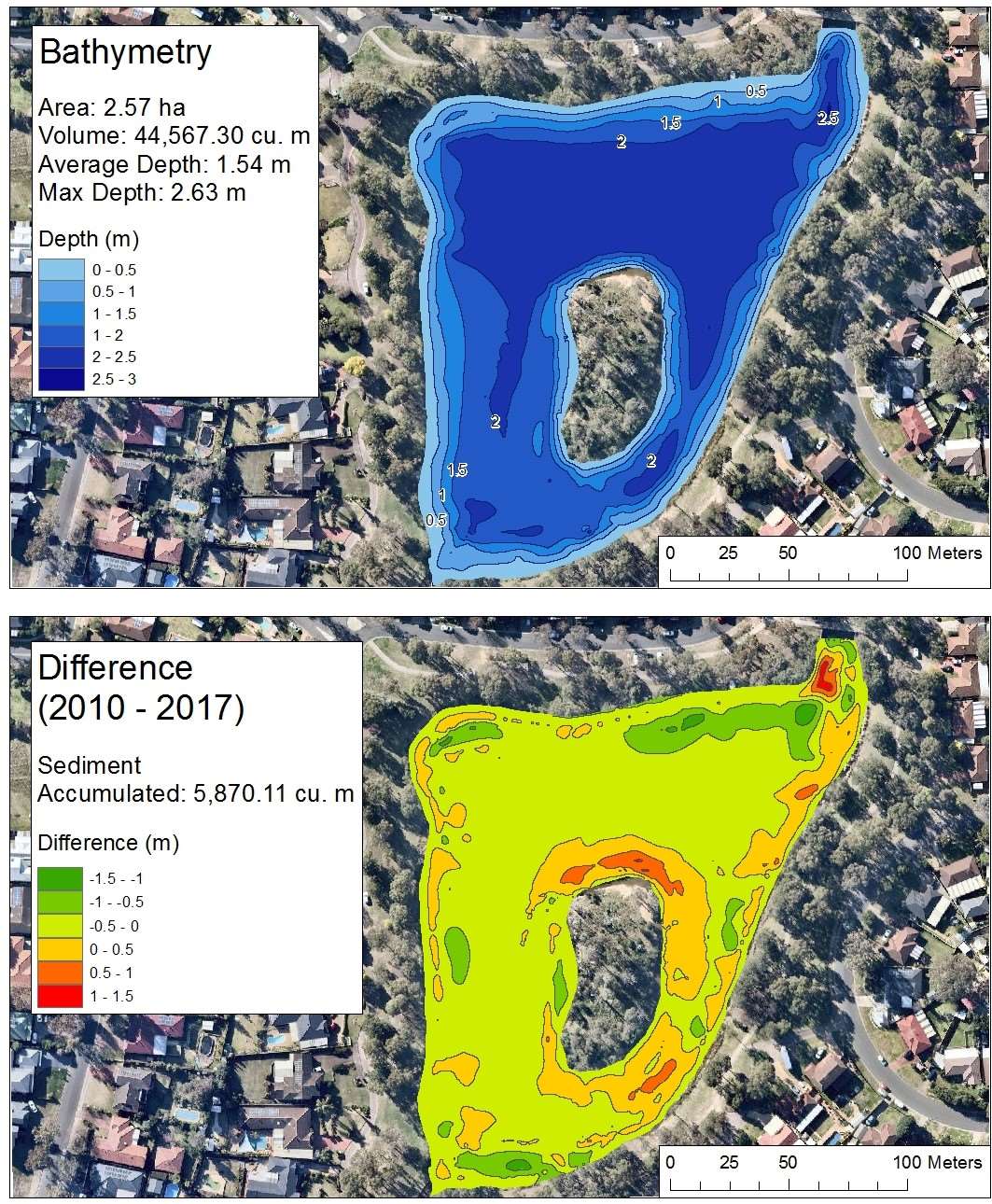
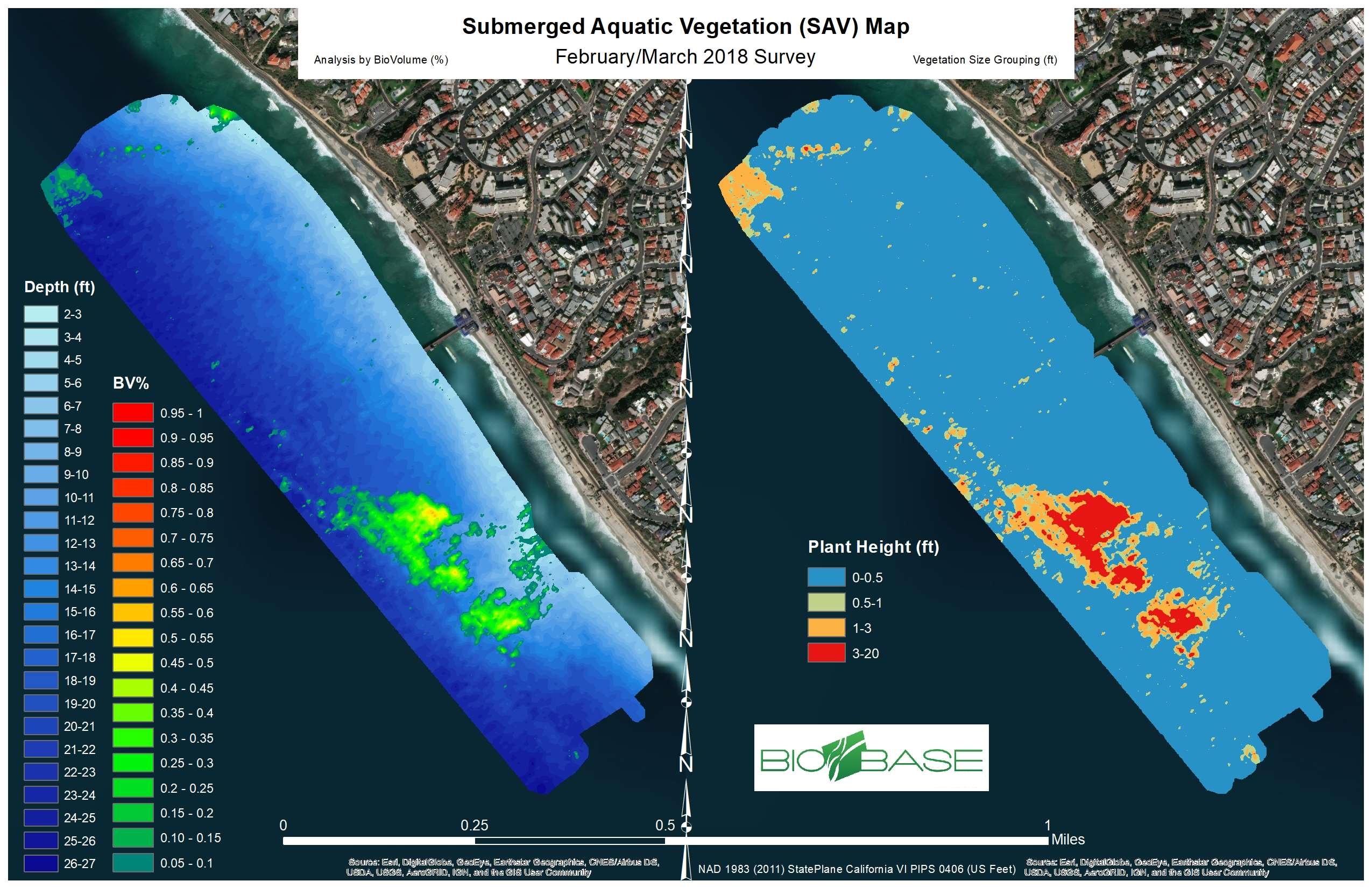
• High resolution custom maps (bathymetry, vegetation, substrate, habitat)
• Sediment analysis and accumulation/change detection
• Data cleansing, QA/QC, and historical survey alignment
• Custom modeling and analytics (volume, treatment dosing, suitability indices)
• Enterprise ready exports (shapefiles, GeoJSON, web map tiles, reports)